After exploring the waterfalls and other scenic sights of southern Iceland, we continued east on the Ring Road. Over the next day, we would have multiple chances to see different pieces of the massive Vatnajökull, the largest glacier in Iceland.
As we drove along the Ring Road, we were able to get glimpses of the different “tongues” of the glacier spilling down over the mountains. As we neared one section of the glacier, the surrounding scenery was replaced by a flat plain with very little vegetation. This was the result of a jökulhlaup: a massive flood (filled with icebergs) caused by geothermal events rapidly melting a part of a glacier. The highway was broken up by many metal one-lane bridges that were quite scary to navigate (there are sections in the middle that are two vehicles wide to allow for waiting). This is because parts of the Ring Road had been washed away in a jökulhlaup in 1996. Compounding the stress of driving through this section was the fact that it started raining very hard!
Skaftafell National Park – Svartifoss Waterfall
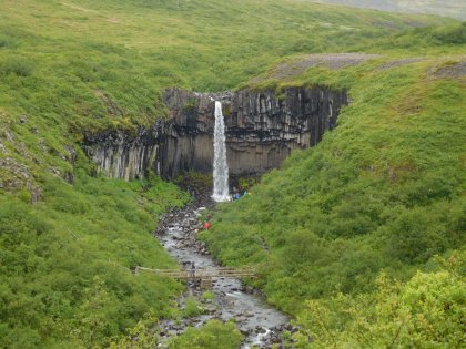
We were able to make it through the pouring rain to main entrance of this national park situated at the foot of a tongue of Vatnajökull. We were trying to find the trailhead for one particular trail based on a point on our maps app, but could not actually get there so just went to the crowded visitor center instead. It’s a good thing we did, because that’s where the trail started anyway. It was still raining, so we took some time exploring the visitor center and watching a film about the area, and eating a quick lunch in the car. We then put on a bunch of layers and headed out on the hike to Svartifoss.
The hike was labeled as “easy” at the visitor center, and while it wasn’t rocky, it definitely included a steady and significant elevation gain. We got very sweaty under all of our layers, and it wasn’t even raining much anymore. The waterfall was not as big as the ones we had seen in the previous days, but its background of black basalt columns made for an unique setting.
Svínafellsjökull
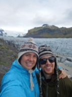
Just past Skaftafell was a dirt road turnoff for a viewing area of Svínafellsjökull, another tongue of Vatnajökull. This was our first chance to get a close view at a glacier. Just past the parking area is a small trail along the wall of a canyon that contains the massive amount of ice. We sat for a while and tried to take in the sheer amount of ice spilling down from the peaks above into the bay below.
Fjallsárlón Glacial Lake
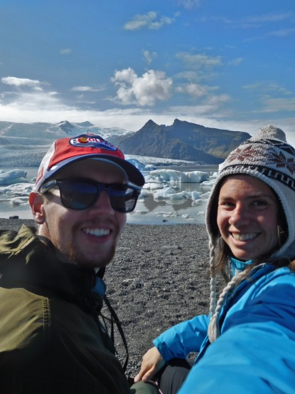
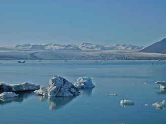
We continued on the Ring Road around the southeast corner of the island and starting heading north along the eastern coast. Our next stop was at Fjallsárlón, a glacial lake made where another tongue of Vatnajökull has formed a body of water and deposits icebergs. It is less well known and visited than the neighboring Jökulsárlón glacial lagoon (although still relatively crowded). We walked down to the shore of the lake and enjoyed the views of the icebergs on the water and Vatnajökull in the distance.
We stayed here for about 40 minutes. A note to interested visitors: there is no public toilet here.
Jökulsárlón
Just up the road was Jökulsárlón, the more famous (and crowded) glacial lake filled with icebergs with a small channel connecting out to the ocean. We enjoyed watching as a few big icebergs started slipping down the channel, only to be caught on a shallow part.
We followed the channel out the ocean and the black sand beach, where there were small remnants of icebergs that the ocean had pushed back onto shore.
To cap off our visit, we walked back out to the main lagoon and watched the big icebergs in the middle, observing their different subtle behaviors. As we were leaving, we noticed a cool effect: the tide had started to come in, so the flow of the channel was reversed, pushing icebergs back into the lagoon.
All told we spent over an hour here, and there were public toilets.
Camping in Höfn
We spent the night at the main campground in the coastal town of Höfn. Lonely Planet says the town’s name “is pronounced like an unexpected hiccup (just say ‘hup’ while inhaling)” – gee thanks, that really clears it up! The campground was fairly crowded but we were able to get a spot in one of the areas off to the side close to an ablutions. The main ablutions block with a kitchen area was a little far away, so we didn’t cook there, but we did wash dishes there, take hot showers (fee required), and spend time in the indoor heated area.
Driving along the Eastern Fjords
The next day was a long travel day, as there were not any sights that we were particularly interested in seeing along the eastern part of the country. However, the drive was scenic, weaving along the coastline and then in and out of the eastern fjords (with Eric taking his first turn driving the manual transmission campervan).
One unexpected highlight was a black pebble beach just off the road, part of Hvalnes Nature Reserve. It was nice and sunny out, which had warmed the smooth black pebbles to a toasty temperature. Della really enjoyed laying on these warm stones and soaking in the heat.
By the end of our long driving day, we had bid goodbye to the wonders of Vatnajökull and its associated tongues and lakes, and were back along the continental divide in the magical area of Mývatn, which will be the subject of our next post!


[…] region. We approached the Mývatn region at the end of a long travel day that started in the southeastern part of Iceland, taking a slight detour towards the end of our long driving day to visit Dettifoss, the most […]